
Reality Capture for Everyday AEC Documentation
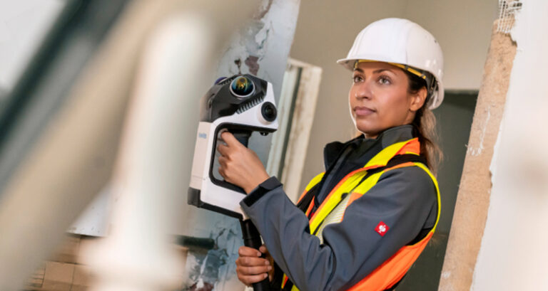
In Architecture, Engineering and Construction, not every reality capture project is a major survey.
Much of the work happens in the spaces between larger projects: documenting existing conditions before design begins, checking dimensions during construction, assessing a site, verifying quantities, or capturing an as-built record for future use.
For AEC teams, these tasks are often high-volume and highly repeatable. The challenge isn’t simply capturing reality – it’s doing so quickly, consistently and accurately enough to keep design and construction workflows moving.
That’s where the NavVis CLX handheld LiDAR scanning system comes in.
Designed specifically for everyday documentation, NavVis CLX brings professional reality capture into the routine AEC workflows that take place across floors, buildings, construction sites and facilities.
Turning everyday site visits into usable reality data
AEC projects depend on reliable information about the built environment.
Architects need accurate existing conditions to develop designs. Engineers need dependable spatial information to coordinate systems. Contractors need site data to plan and verify work. Surveyors need efficient ways to document spaces and conditions. And facility teams need an accessible record of what exists after construction is complete.
Yet capturing that information can become a bottleneck when every site visit requires specialist equipment, extensive training, or complicated workflows.
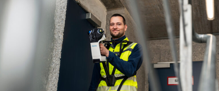
The NavVis CLX is designed to make reality capture easier to integrate into these everyday activities. Its compact, lightweight design and straightforward operation allow teams to deploy it frequently across different jobs and environments. Whether documenting an existing building for renovation, referencing an area before construction, assessing a site, or collecting information for quantity surveying, the workflow is designed to be simple and repeatable.
Capture existing conditions before design begins
Renovation, refurbishment and retrofit projects depend heavily on existing-condition information. Before an architect or engineer can confidently design changes to a building, they need to understand what is already there. Walls, openings, spaces, structural elements, MEP systems and other site conditions all form part of the reality that a design needs to respond to.
NavVis CLX provides a practical way to capture that reality and create a reliable spatial record. Its dual LiDAR architecture, combined with live 2D and 3D visualisation, allows operators to see the space as they capture it. Coverage feedback helps identify areas that may have been missed while the team is still on site.
That matters particularly in refurbishment and retrofit projects, where returning to an occupied building to capture a missed room, corridor, or difficult-to-access area can disrupt schedules and increase project costs.
With NavVis CLX, teams can check their coverage as they work and leave the site with greater confidence in the completeness of their documentation.
Supporting Scan-to-CAD and BIM workflows
Reality capture becomes particularly valuable when it can feed directly into the digital workflows used by AEC teams.
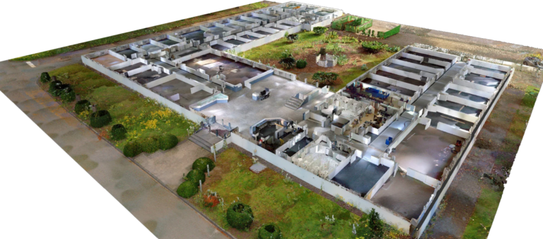
NavVis CLX supports LOD200 Scan-to-CAD/BIM workflows, providing clean, structured point cloud data that can serve as a foundation for downstream modelling and documentation.
For architects and engineers, point clouds can provide reliable geometry to reference when developing drawings and models. For BIM teams, they provide a connection between the physical building and its digital representation.
Cleaner data can also reduce the amount of manual interpretation required during modelling. Less noise and fewer unwanted artifacts can make it easier to identify walls, spaces and other building elements and translate them into CAD or BIM environments.
The goal isn’t simply to produce a point cloud. It’s to produce usable project information.
Keep construction documentation moving
Construction sites change constantly. A space that was captured before construction may look very different weeks or months later. Walls are installed, services are routed, equipment is positioned and finishes are completed. Regular reality capture can help teams maintain a current record of those changes.
NavVis CLX is designed for the kind of repeatable documentation that construction workflows often require. Teams can use it to document site conditions at different stages, support progress verification, capture information for coordination, or create records that can be referenced later.
Because the device is compact and designed for frequent use, it can become part of a team’s regular site documentation process rather than something reserved for occasional specialist surveys.
From the job site to the project team
Capturing the space is only one part of the workflow. AEC teams need that information to move from the field into the platforms and applications where it can support decisions.
NavVis CLX works with IVION Processing and IVION to provide a streamlined path from capture to processed and accessible reality data.
Captured data can be processed into registered point clouds using IVION Processing and then managed and accessed in IVION. Project stakeholders can explore the captured environment, take measurements, support planning activities and verify conditions without relying solely on another site visit.
Point clouds can also be exported in various formats, including orthophotos, while point clouds can be streamed directly into Revit for CAD and BIM workflows. This creates a more connected workflow between the physical site and the digital project environment.
One capture, multiple AEC use cases
One of the advantages of building a digital record of an existing space is that the information can continue to provide value beyond the original reason for capture:
- A scan captured for design development may later help with coordination.
- A site record created for construction planning may support verification.
- An existing-condition capture may become a reference for facilities teams after handover.
- A point cloud created for modelling may also provide a useful record for future measurements and assessments.
This makes reality capture more than a one-off deliverable. It can become part of the project’s information infrastructure. With data accessible through IVION, the captured environment can remain available to different project stakeholders as work progresses.
Making high-volume documentation more efficient
For AEC businesses, efficiency isn’t only about completing one project faster. It’s about creating a repeatable process that works across many projects.
When teams regularly document floors, buildings, construction sites and facilities, small improvements in field capture and data preparation can have a significant impact:
- Faster deployment can reduce time spent getting ready for a site visit.
- Live coverage feedback can reduce the risk of missing information.
- Cleaner point clouds can reduce downstream modelling effort.
- Connected processing and data access can make information easier to share across the project team.
Together, these efficiencies can help AEC organizations reduce unnecessary site visits, increase project capacity and maintain a more consistent standard of documentation.
Reality capture that fits the AEC workflow
The future of reality capture isn’t only about capturing more data, it’s about making that data easier to capture, easier to trust and easier to put to work.
For AEC teams, that means technology needs to fit the realities of everyday projects: occupied buildings, active construction sites, tight schedules, changing conditions, multiple stakeholders and an ongoing need for reliable information.
NavVis CLX is built around those requirements. As part of the NavVis LX-Series, it complements NavVis MLX and NavVis VLX by extending professional reality capture into frequent, repeatable documentation workflows.
From existing-condition surveys and site assessments to quantity surveying, construction documentation and Scan-to-CAD/BIM, NavVis CLX provides AEC teams with a practical way to capture the built environment and carry that information into the digital workflows that follow.
Because when reality capture becomes part of the everyday AEC workflow, the real value isn’t just the scan, it’s having reliable information about the building or site, when and wherever the project team needs it.
Read More about NavVis CLX or Contact Us for more information.