
NavVis Laser Scanning | Mobile Mapping Systems
Industry-leading wearable and handheld laser scanning systems
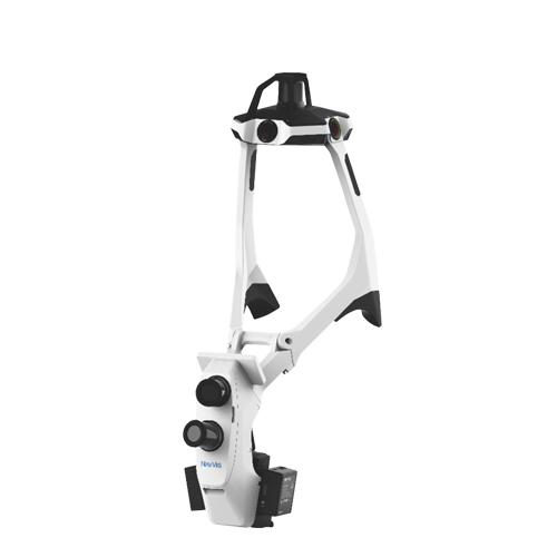
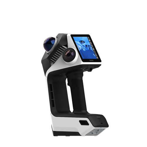
NavVis laser scanners are industry-leading mobile mapping systems designed for fast, accurate 3D reality capture. Using advanced SLAM technology, NavVis VLX3, MLX and CLX scanners allow surveyors, engineers, and construction professionals to capture high-density point cloud data without the need for static setups.
Whether you’re scanning buildings, infrastructure, or industrial environments, NavVis delivers survey-grade accuracy with unmatched speed and efficiency.
What is a NavVis Laser Scanner?
NavVis laser scanners are wearable and handheld mobile mapping systems that use
SLAM (Simultaneous Localisation and Mapping) technology to capture accurate
3D spatial data while moving through an environment.
Unlike traditional terrestrial laser scanners, NavVis systems allow users to scan large areas quickly
without stopping at multiple setups, making them ideal for construction, surveying, and digital twin workflows.
Fast, mobile 3D laser scanning
Survey-grade accuracy using SLAM technology
Ideal for large and complex environments
Efficient reality capture for BIM and digital twins
Featured Products


NavVis vs Traditional Laser Scanners
Compare how NavVis mobile mapping systems stack up against traditional laser scanners in real-world workflows.
| Feature | NavVis (VLX / MLX / CLX) | Traditional Laser Scanner |
|---|---|---|
| Speed | Very fast (walk & scan) | Slow (static setups) |
| Accuracy | Survey-grade | High |
| Workflow | Mobile mapping (SLAM) | Tripod-based |
| Best for | Large environments | High-detail static scans |
| Efficiency | Extremely high | Lower |
What is NavVis Laser Scanning Used For?
NavVis laser scanning supports a wide range of applications across construction, surveying, and industrial environments by enabling fast, accurate 3D data capture.
Capture accurate site data for planning, progress tracking, and coordination.
Create detailed as-built records of existing structures.
Generate accurate 3D models for digital twin environments and simulations.
Improve maintenance and operations with precise spatial data.
Scan complex industrial environments quickly and safely.
Support BIM modelling with accurate point cloud data.
NavVis Laser Scanning in Sub-Saharan Africa
BuildingPoint SA is an authorised NavVis distributor in Sub-Saharan Africa, providing access to industry-leading mobile mapping systems, support, and training for surveying, engineering, and construction professionals.
Frequently Asked Questions
Common questions about NavVis scanners, accuracy, and use cases.
What is a NavVis scanner used for?
NavVis scanners are used for capturing 3D spatial data for construction, surveying, and digital twin applications.
How accurate is a NavVis laser scanner?
NavVis systems provide survey-grade accuracy using advanced SLAM algorithms.
What is the difference between NavVis VLX and MLX?
VLX is a wearable system for large environments, while MLX is a handheld scanner for smaller or confined spaces.
Is NavVis better than traditional laser scanning?
NavVis is faster and more efficient for large areas, while traditional scanners may be better for ultra-high-detail static scans.
Who distributes NavVis in Sub-Saharan Africa?
BuildingPoint SA is an authorised NavVis distributor in Sub-Saharan Africa.