
XGRIDS 3D Scanners and Reality Capture Solutions
Leading the world in 3D Intelligent Spatial Computing
XGRIDS brings together handheld LiDAR scanning, SLAM technology, panoramic imaging, AI-assisted processing and 3D Gaussian Splatting to help teams capture accurate spatial data without the slow setup process of traditional static scanning.
For construction and built-environment professionals, this means faster as-built documentation, easier site verification, improved digital twin creation and more efficient scan-to-BIM workflows. Instead of relying only on manual measurements or static scanner setups, users can walk through a site and capture usable 3D data quickly.
The XGRIDS range includes compact handheld scanners for field capture, advanced LiDAR systems for larger and more demanding environments, and software tools for processing point clouds, producing immersive 3D models and connecting capture data into BIM, CAD and GIS workflows.
As an appointed XGRIDS dealer, BuildingPoint SA helps clients choose the right scanner and software combination for their project requirements, from construction documentation and facility management to visualisation, mapping and digital twin workflows.
XGRIDS Hardware
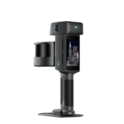


Which XGRIDS Solution is Right for Your Workflow?
Each XGRIDS product serves a different purpose. Use the guide below to compare the hardware and software options available through BuildingPoint SA.
| Solution | Best For | Main Output | Typical Use Case |
|---|---|---|---|
| PortalCam | Photorealistic 3D capture | 3D Gaussian Splatting models | Virtual walkthroughs, real estate, visualisation and immersive site documentation |
| LixelKity K1 | Compact handheld scanning | True-colour point clouds | Fast indoor mapping, smaller sites and general reality capture |
| Lixel L2 Pro | Advanced mobile LiDAR capture | High-density point clouds | Construction verification, surveying, infrastructure, BIM and larger environments |
| Lixel CyberColor | Photorealistic model generation | 3DGS visual models | Creating immersive digital spaces from captured scan data |
| LixelStudio | Point cloud processing | Processed scan data | Measurement, analysis, point-cloud clean-up, BIM, CAD and GIS workflows |
Capture, Process and Deliver 3D Site Data Faster
XGRIDS solutions are designed to simplify the full reality capture process. Teams can capture real-world spaces using handheld LiDAR scanners or spatial cameras, process the data through XGRIDS software, and then use the outputs for digital twins, BIM coordination, visualisation or site documentation.
This makes XGRIDS especially useful for teams that need to reduce manual measurement, improve documentation accuracy and create usable 3D deliverables without slowing down project progress.
Capture
Scan your site, building or asset using PortalCam, K1 or L2 Pro.
Process
Use LixelStudio or CyberColor to prepare point clouds or photorealistic 3D models.
Deliver
Use your data for BIM, CAD, GIS, digital twins, walkthroughs and project documentation.
What Can XGRIDS Be Used For?
Construction Verification
Capture as-built site conditions and compare real-world progress against design intent.
Scan-to-BIM
Create accurate point-cloud data that can support BIM modelling, documentation and coordination.
Digital Twins
Build digital representations of buildings, facilities and infrastructure for smarter asset management.
Surveying and Mapping
Capture large areas faster with mobile LiDAR workflows for indoor and outdoor environments.
Facility Management
Document existing buildings and facilities to support planning, maintenance and future upgrades.
Visualisation and Walkthroughs
Create immersive 3D environments for presentations, client reviews and remote site access.
Understanding the XGRIDS Ecosystem
XGRIDS supports both measurement-focused and visual-first workflows. Point clouds are ideal when you need measurable 3D data for construction, surveying, BIM and engineering workflows. Gaussian Splatting is better suited to highly realistic 3D visualisation, walkthroughs and immersive digital spaces.
This is why choosing the right XGRIDS system matters. The K1 and L2 Pro are better suited to LiDAR and point-cloud workflows, while PortalCam and CyberColor are focused on photorealistic 3D capture and visualisation.
XGRIDS Frequently Asked Questions
Which XGRIDS scanner is best for construction?
The Lixel L2 Pro is generally the stronger option for larger construction, surveying and scan-to-BIM workflows, while the K1 is better suited to compact handheld capture and smaller environments.
What is the difference between PortalCam and the Lixel scanners?
PortalCam is focused on photorealistic 3D Gaussian Splatting capture, while the Lixel K1 and L2 Pro are handheld LiDAR scanners used for point-cloud and reality capture workflows.
Can XGRIDS be used for BIM workflows?
Yes. XGRIDS point-cloud data can support scan-to-BIM, construction verification, as-built documentation and coordination workflows.
Does BuildingPoint SA provide XGRIDS demos and support?
Yes. BuildingPoint SA can assist with product guidance, demonstrations, training and support for XGRIDS hardware and software solutions.
Need Help Choosing the Right XGRIDS Solution?
Speak to BuildingPoint SA about XGRIDS scanners, software, pricing, demos and training for your construction, surveying or digital twin workflow.
Speak to a Specialist